A Brief History of Bohemia – part 9 – Bench Marks & Boundary Stones
By Edward Preston (Sep 2009)
It was in 1783 that the Ordnance Survey was commenced, to provide accurate mapping of the country, initially for military purposes. The method used was known as triangulation, making calculations by trigonometry from the readings taken. The work began at Hounslow Heath where there was a vast expanse of level land (hence the subsequent development of Heathrow Airport).
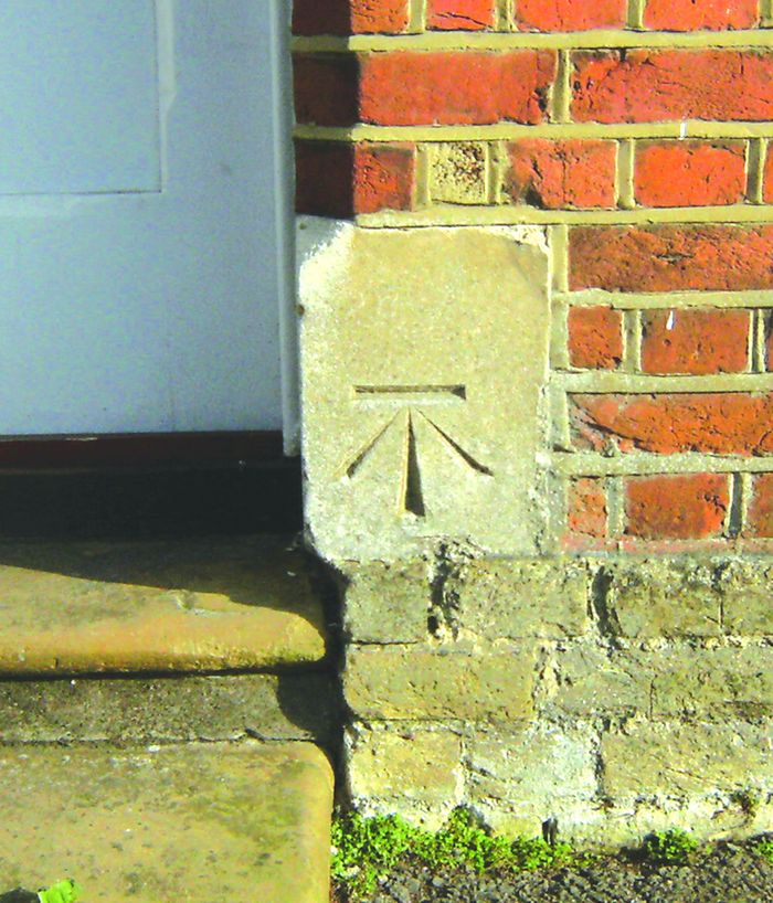
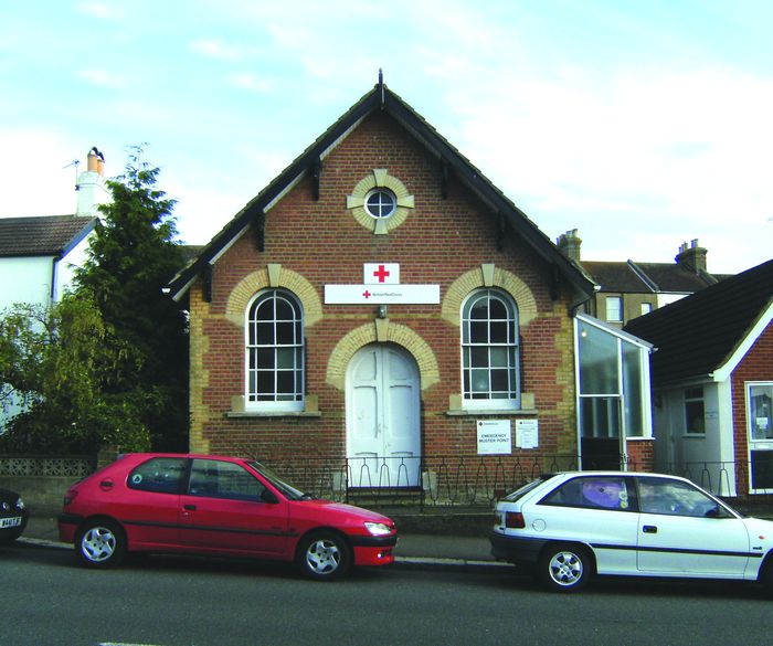
From the survey, at specific points where the height above sea level had been taken, bench-marks were etched into masonry that was thought unlikely to be disturbed. The word: ‘benchmark’ has come into the language for a standard by which things are measured; but originally it was used simply referring to the sign [see photo, right, of mark on Newgate Hall], representing the end profile of a bench. By referring to the map relevant to the bench-mark, the height of that point can then be found.
The man appointed to undertake the survey was General Roy. During his tenure of office,he established a signalling station towards Fairlight. In Bohemia, several bench-marks are still clearly visible – the best example being on Newgate Hall, to the right of the original entrance in Newgate Road. Others can be seen at the following locations: on a pillar close to Bohemia Lodge in Clarence Road at the entrance to Alexandra Park; and on St Peter’s Church in Cornfield Terrace.
The one on Park Road Methodist Church became hidden when the new extension was added. Most others marked on the 1873 edition of the O.S. map have disappeared from view, either through demolition, alteration to buildings, or erosion. I should be pleased to hear of others in the Bohemia area tracked down by readers.
Whilst having your eyes near ground level, you may also wish to trace the remaining parish boundary stones and similar markers. Several can be found in Tower Road, Newgate Road, on the path through Newgate Wood, at the foot of Brisco’s Walk and at Springfield Road near Buchanan Gardens.
The practice of ‘beating the bounds’ has largely ceased. It was normally carried out on Ascension Day, when parishioners would walk the boundary of their parish, and at the points where the stones stood, would beat the ground with willow wands. However, sometimes more violent activities were employed to impress on the parish youth the extent of their parish.
Leave a Response
You must be logged in to post a comment.


